Capture Existing conditions before the design phase. Document and share construction progress. Save travel time for remote inspections. Speed up subcontractors’ estimates. Communicating by annotating 3D modes with notes, links, photos, and videos. Increase job safety by flying to hard-to-reach places. Add another product to Surveyor’s portfolio
Maps and models produced with 2X the quality of many drones, capturing every detail of a job site with the DJI Matrice 300 and P-1 45MP camera.
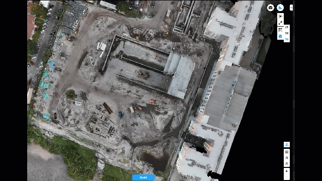
Gathering data aligned with coordinates provided by surveyors in partnership enhancing their data collection with overhead views of the job site.
Frequent flights on the same path recording progress and exporting to major software used by AEC planners
Collect data for 2D orthomosaic maps and 3D models captured with industry-leading drone/camera combinations providing greater clarity for inspections and reports.
PhotosinMotion.net is happy to partner with independent surveyors or companies with surveyors to provide data collection through photogrammetry to enhance productivity and increasing the project’s success.
PhotosinMotion.net provides files for upload directly into software such as Autodesk, Revit, and more. Use the point cloud to quickly create an as-built model and jump-start projects. Combine 2D and 3D maps and Matterport walkthroughs for one fully immersive experience of your job site.
PhotosinMotion.net is ready to help with all your real estate marketing needs. Please contact us to have your listing displays in style.
This website uses cookies.