by admin | Apr 5, 2025 | Architect Engineering Construction, Real Estate Photography
Matterport 3D Virtual TourSet Your Business Above the Competition! Learn More Experience a Matterport True 3D Virtual Tour Place your business above the competition with a 3D scan created by the State-of-the-Art Matterport 3D Virtual Tour system. These Scans allow you...
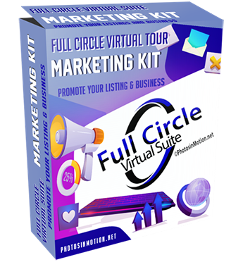
by admin | Apr 4, 2025 | Architect Engineering Construction, Real Estate Photography
Full Circle Virtual Suite Puts You in Front of Homebuyers and Sellers Click to start promoting your brand Created by Realtors For Realtors Start Promoting Your Brand Today! Full Circle Virtual Suite wraps all your listing information, pictures, and video with your...
by admin | Mar 30, 2025 | AEC Information
Drone Maps and Models Capture Existing conditions before the design phase. Document and share construction progress. Save travel time for remote inspections. Speed up subcontractors’ estimates. Communicating by annotating 3D modes with notes, links, photos, and...
by admin | Mar 30, 2025 | AEC Information
Increase Efficiency and Reduce Costs on Architect, Engineering, and Construction (AEC) Projects Drone Mapping and 3D Walkthrough Services Capture Existing conditions before the design phase. Document and share construction progress. Save travel time for remote...